Case Study of DW runs in the Solent
Posted by Christian Humphrey on 4th Nov 2025
I learnt quickly that the tide totally dictates when and where the Solent DW runs are on. Get it right and conditions can be great (although always with a bit of challenge - this is not the Gorge!), with a long paddle your reward for getting it wrong.
For context I use a 1201 on all these runs, on a 6'10x20x90L Swift foil board and I weigh 67kg.
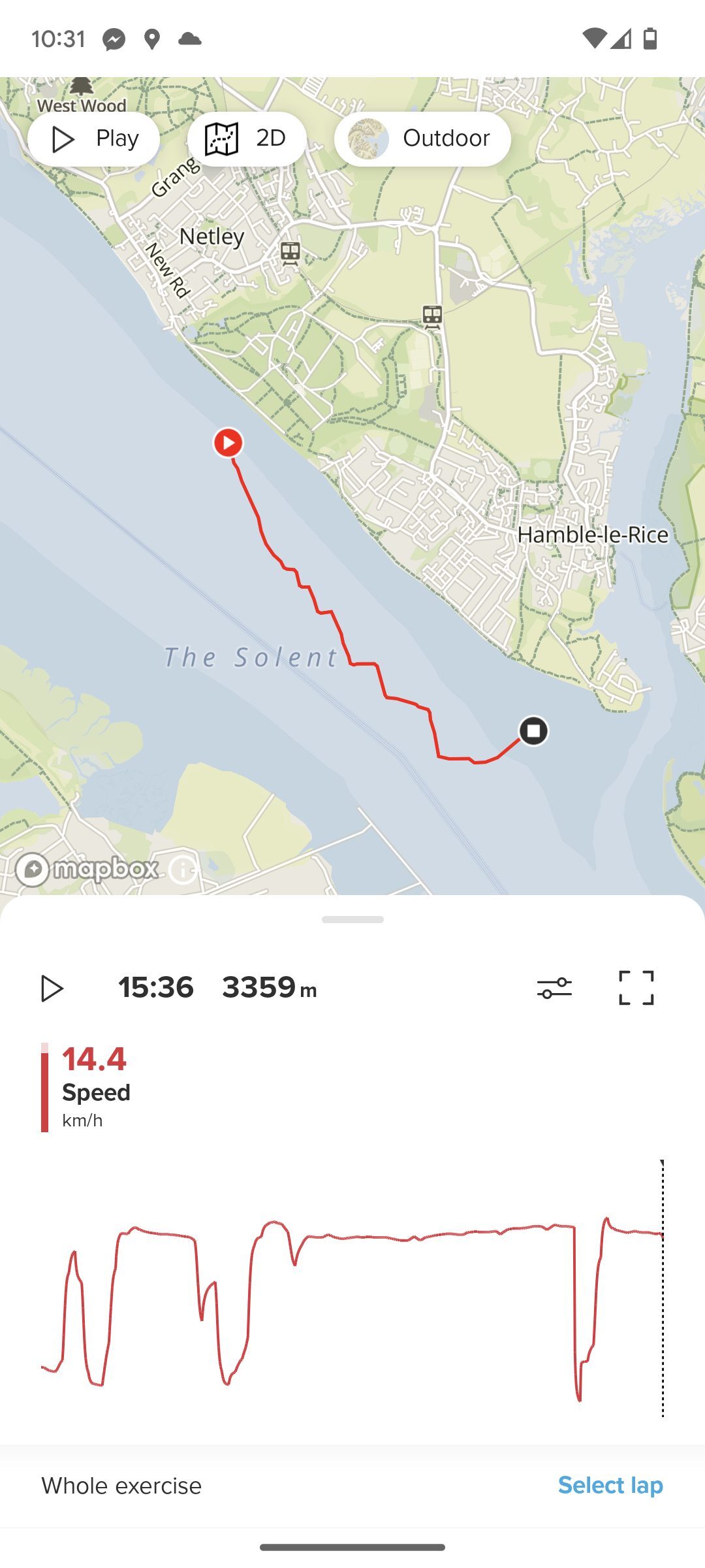
My local spot, blessed to live a 5 min cycle from the northern shore, and this is where I have done most of my DW training. It runs NW to SE so wind from either of these directions work, although from the SE works better, due to the longer fetch and a quirk of the tides which means the tide goes out over 3 hours, but takes 9 hours to come in. This means when it goes out, it rips out, giving an extra boost to the energy available. NW'ly is more common, but due to the short fetch, don't launch further north than Victoria Country Park. In a SE'ly park at Hamble Point, or Ensign Way.
A solid 15 knots is plenty when it's punching against the tide (assuming your paddle up is ok), and you can get a 3km run in a NWly and a 5 km run in a SE'ly. There will always be wakes kicked up from boat traffic and bounce back of sea walls to keep you on your toes.
There is a walkable path along the whole of the northern shore, so there is no need to arrange a shuttle, you just need to be comfortable carrying your kit. This also means the run has a bail out at any point, so is safe.
Live wind and tide data is best looked at on Sotonmet, but remember that the weather station is 50m up so generally over reads at ground level or WeatherFile.com - Hythe Ferry Pier.

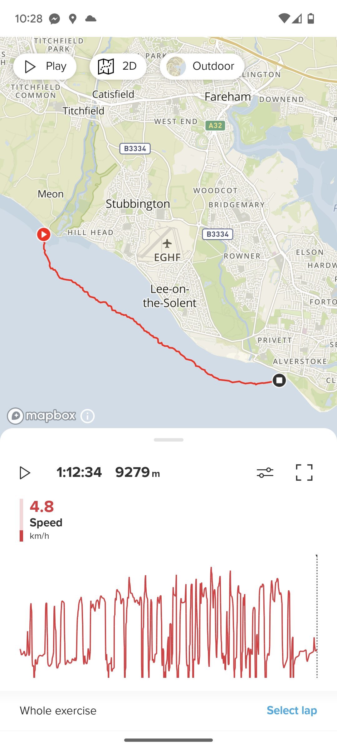
The next step up for DW runs in the Solent in a W to NW wind, and gives a run of about 9km. The other key factor is Portsmouth high tide time, which is the time when the tide in the Solent starts really running west, against the wind, so launch around that time.
Things to note are that the water state at the beginning can often be a mess, but cleans up after a km or so, and can get tricky again on the final approach (I tend to finish at Stokes Bay Sailing Club) as it gets more sheltered towards the shore.
The nice thing about this run is that there are bail out options for most of the way, and if you have support crew following you in a car, they can watch you and track your progress most of the way too, with only Browndown Point being inaccessible.
Live weather and tide data are on Bramblemet, but also WeatherFile.com - Calshot.

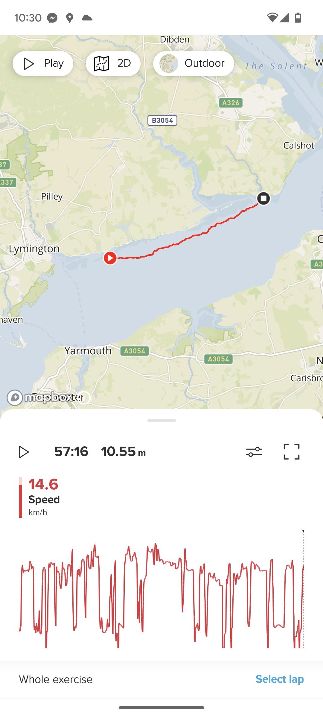
Tanners Lane/Lymington to Lepe Country Park.
This is probably the best run in the Solent (for the moment anyway!) mainly due to it working in a prevailing SW'ly and offering the cleanest conditions. It's a 10km run, which has limited easy bail out options, so not one for starting on.
Logistics is a bit of a pain as it's a 30 min car journey from Tanners to Lepe despite the short distance, and Lepe itself is a bit away from everything. There are obvious extension to the run, with a start from perhaps Hurst Castle (which will require a walk) and finish at Calshot, (things can get shallow around Calshot so be careful of your foil!) but I've not done them yet.
Live wind data can be found at WeatherFile.com Hurst Castle and again, you want to be launching around Portsmouth high tide time.

Shout out to Dom Maddison as we've been each other's wingman on these longer runs, and he's been exploring runs a bit further east of the Solent, which look exciting and have potential too!


